

Zoning tells you how council allows land to be used and developed. In Stash you can see zoning as a colour overlay across the map, and check the exact zone for any property.
Before you start
Map overlays need an active Stash subscription or free trial. If an overlay shows a lock icon, it isn’t included in your account. See plans.
Turn on the Zoning overlay
- Go to the area you’re researching. Search for a suburb or address, or move the map there.
- Open the Layers panel. Click the Layers button on the right-hand side of the map.
- Turn on Zoning. Under Overlays, switch on Zoning. Each zone is shaded in its own colour.
- Pick a basemap. Under Basemaps, choose Street, Satellite Street, Satellite or Metromap Aerial. Overlays are easiest to read on Street.
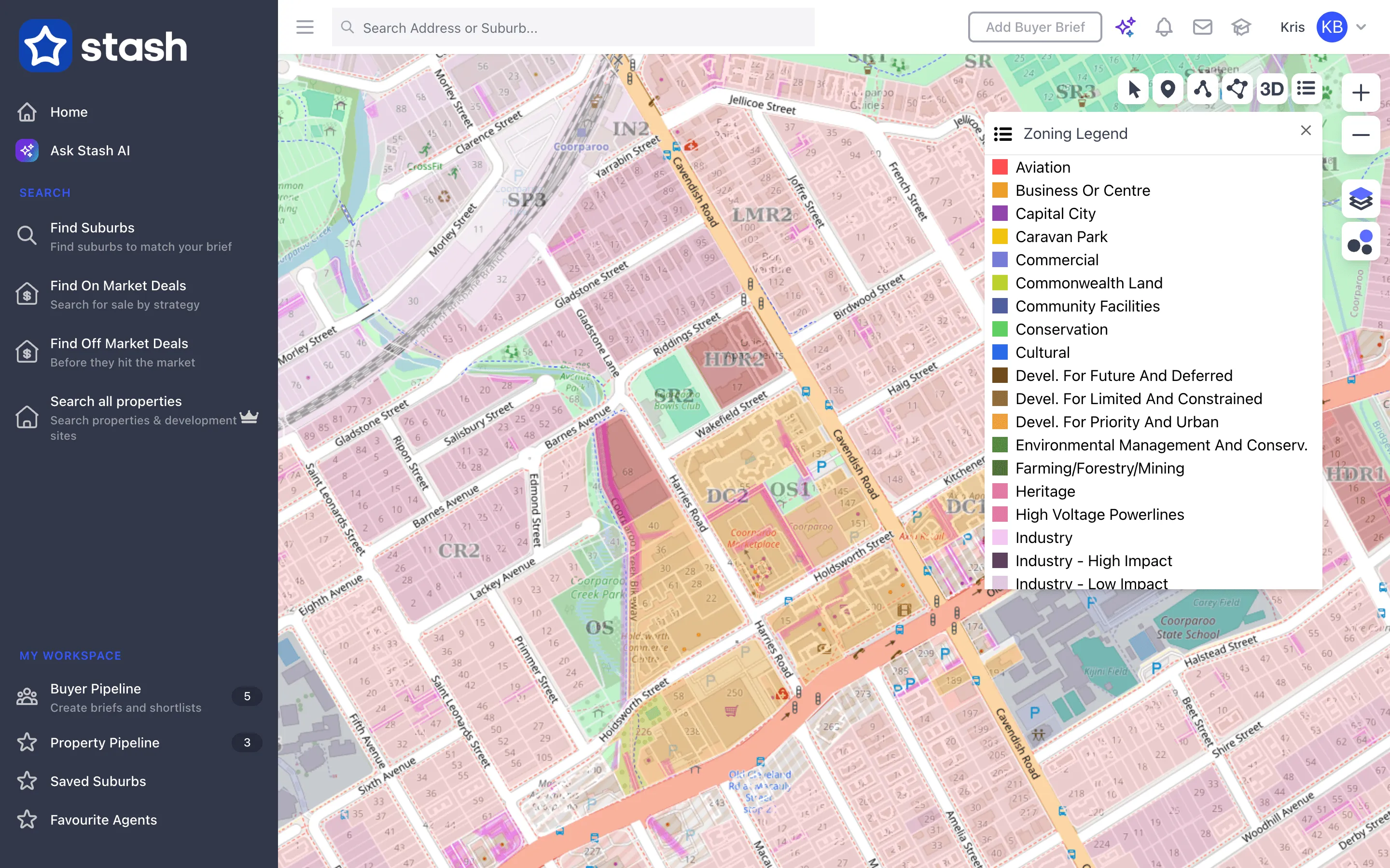
Read the zoning legend
Click the Zoning Legend button in the toolbar at the top right of the map. It lists every zone colour, from Residential - Low Density through to Mixed Use, Industry, Rural, Conservation and more.
Stash groups each council’s zone names into these common categories so the colours mean the same thing across the country. For the council’s own zone name, check the property itself (below).
Check the zone for a property
- Open the property. Click the property on the map, or search for its address.
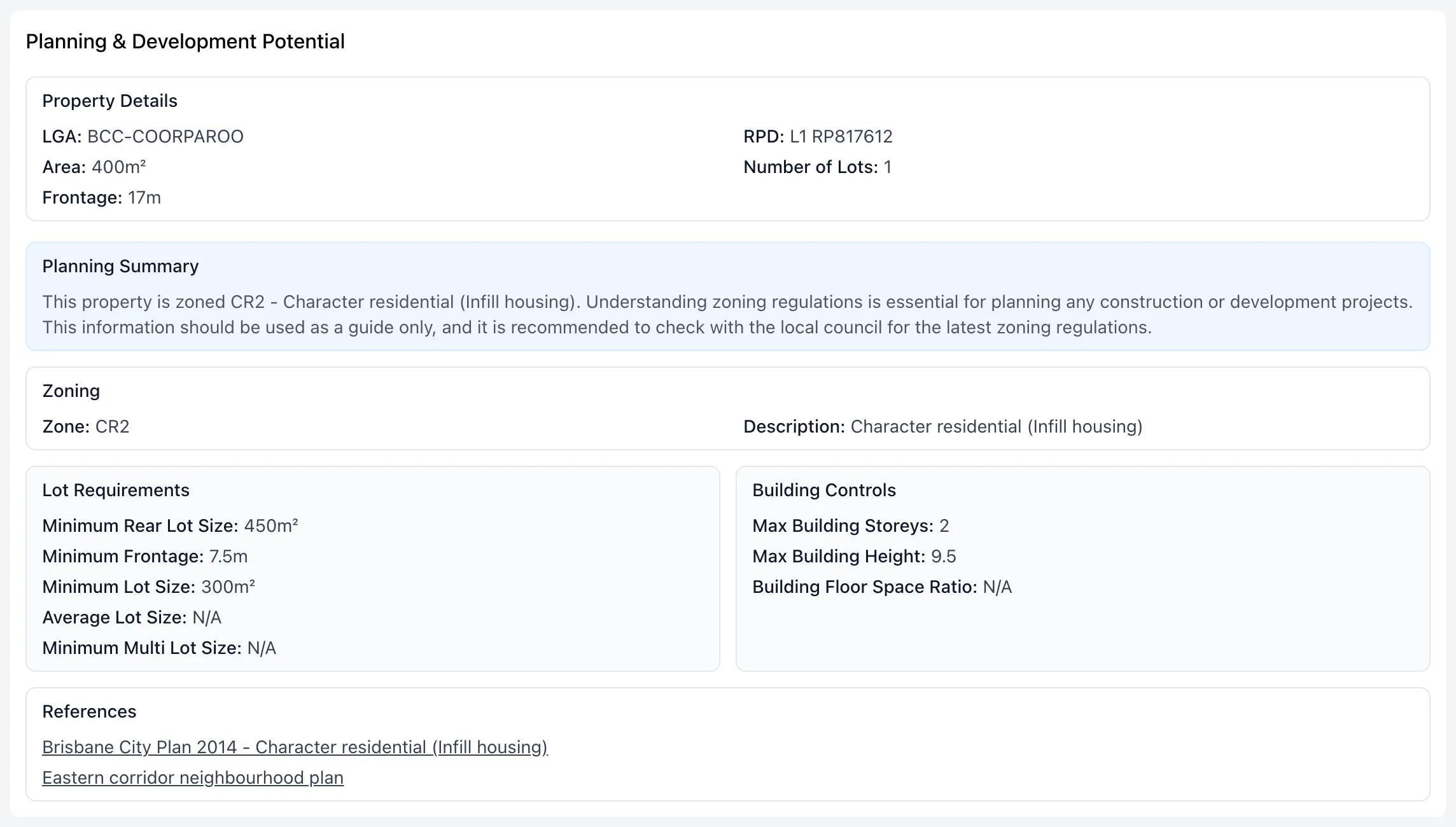
- Open the Planning Insights tab. The Planning & Development Potential card shows a Planning Summary, plus the Zone and its Description. Some properties sit in more than one zone, and each one is listed.
- See the full planning details. On the Property Details tab, click VIEW PLANNING INFO in the Property Description card. See Minimum lot size and zoning details.
You can also search for properties by zone. In Search all properties (Find Prospects for real estate and property services accounts), use the Property Zoning filter. See Find off-market properties.
Zoning in Stash is built from government planning data and is for research. Councils change their schemes and don’t all publish at the same time. Before you buy, build or advise a client, confirm the current zoning with the council or a town planner.
Common questions
Why can’t I see the zoning colours?
Check that Zoning is switched on in the Layers panel, and zoom in closer. If the overlay shows a lock icon, your account doesn’t include it.
Why does the legend show a different name to the council?
The legend uses Stash’s common categories. The council’s zone code and description are on the property’s Planning Insights tab.
Can I see other overlays at the same time?
Yes. You can switch on several overlays together, such as zoning, flooding and heritage. See Map layers and overlays.