

Contour lines join points of equal height, so they show you whether a site is flat, gently sloping or steep. Slope affects building costs, drainage, retaining walls and how many dwellings will fit, so it’s worth checking before you make an offer.
Before you start
Map overlays need an active Stash subscription or free trial. If Contours shows a lock icon, it isn’t included in your account. See plans.
Turn on contours
- Go to the property. Search for the address or suburb, or move the map there.
- Open the Layers panel. Click the Layers button on the right-hand side of the map.
- Turn on Contours. Under Overlays, switch on Contours.
- Switch to the Street basemap. Under Basemaps, choose Street. Contour lines are much easier to see on the street map than on satellite imagery.
- Zoom in. Contours only appear when you’re zoomed in close, at street level. If you don’t see them, zoom in further.
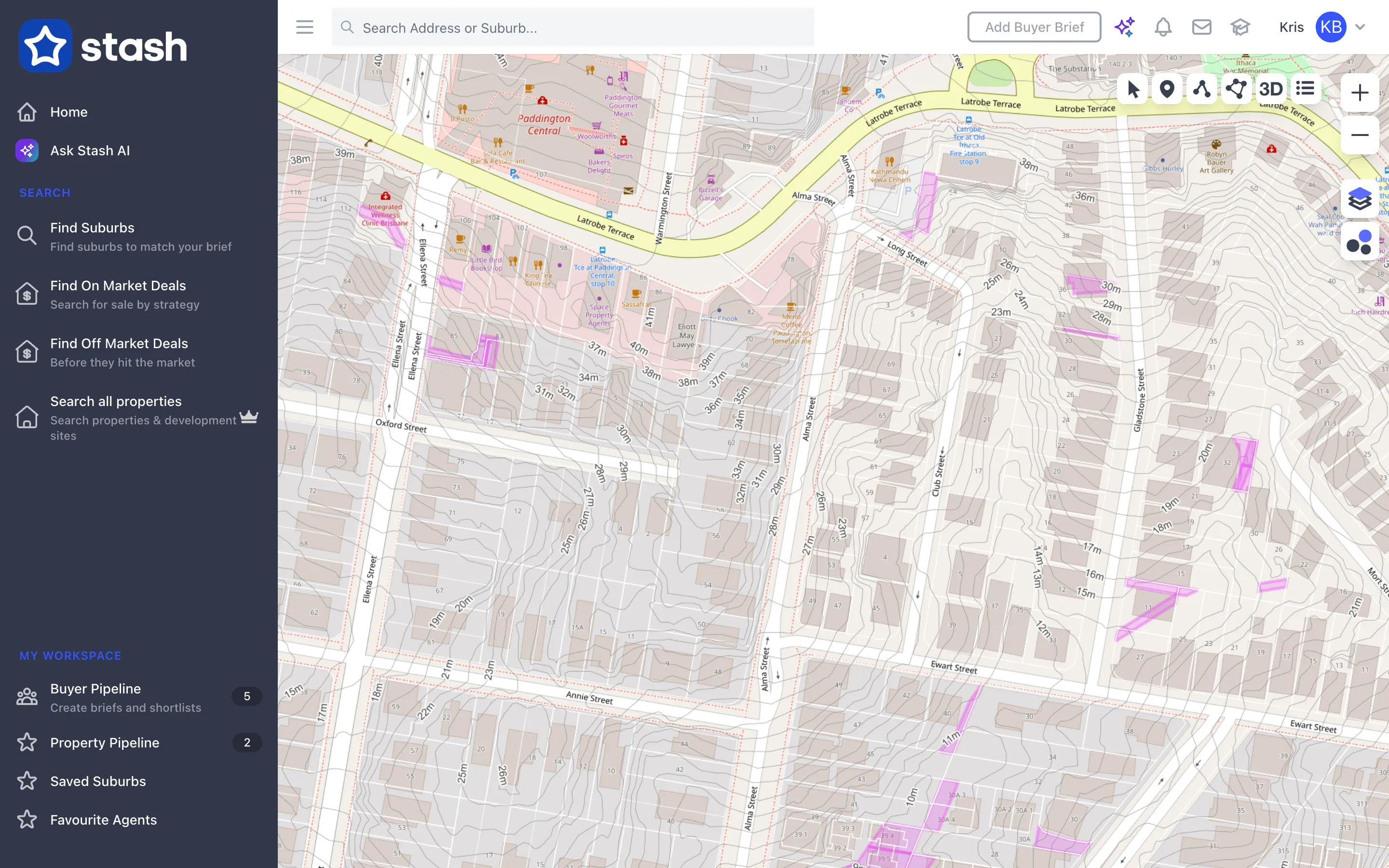
Turn on Boundaries as well, so you can see where the contour lines cross each lot.
Reading contours
- Lines close together mean the land is steep.
- Lines far apart mean the land is flat or gently sloping.
- Lines that bend into a V or U shape often show a gully or a ridge, which affects where water drains.
To estimate the slope across a lot, use Draw Lines to measure the distance between two contour lines. See Measure distance.
You can also check the slope in 3D. Click 3D in the toolbar at the top right of the map. See Switch between 2D and 3D view.
Contours in Stash are built from government elevation data and are a guide only. They won’t show recent earthworks, retaining walls or small changes in level. For design and approvals, get a site survey from a licensed surveyor.
Common questions
Why can’t I see any contour lines?
Zoom in further. Contours only load at street level. Check Contours is switched on and use the Street basemap.
Can I see contours with other overlays?
Yes. Contours work well with Flooding, Boundaries and Zoning. See Map layers and overlays.