

Proximity circles draw rings around a property at set distances, so you can quickly see how far it is to schools, shops, hospitals, train stations and other amenities. They’re a fast way to answer a client’s “how close is it to…?” without measuring.
Turn on proximity circles
- Select a property. Search for the address, click it on the map, or open it from your pipeline. The circles are centred on the selected property.
- Open Layers. Click the Layers button on the right-hand side of the map.
- Turn on Proximity Circles. Under Overlays, switch on Proximity Circles.
- Zoom out. Close the panel and zoom out to see the rings around the property.
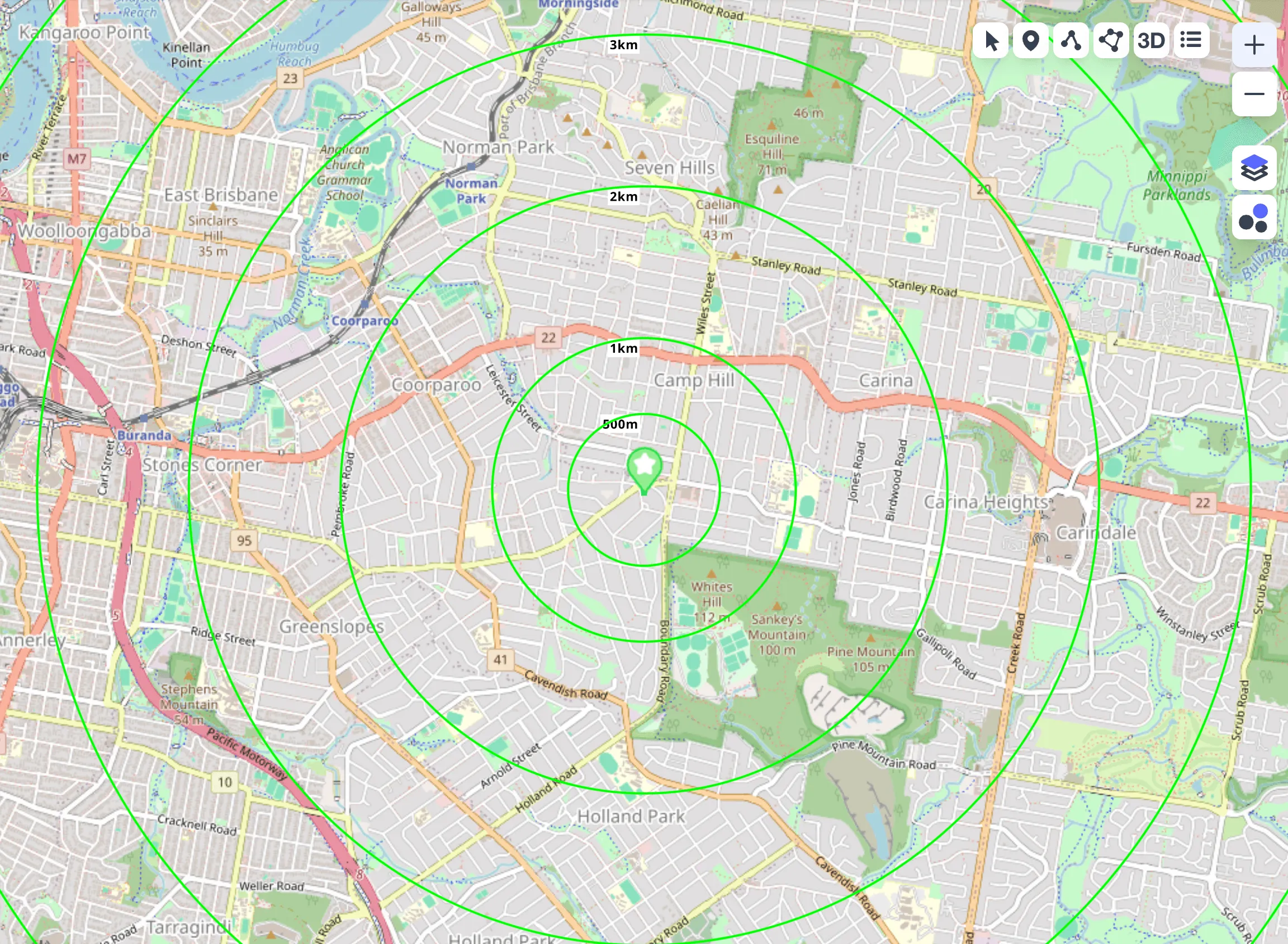
Read the circles
The rings are drawn at 500m, 1km, 2km, 3km, 4km, 5km, 10km, 20km and 30km from the property, and each ring is labelled with its distance. Use them to judge roughly how far an amenity is, then check the exact distance if you need it.
Proximity circles show distance as the crow flies, not travel distance by road. For an exact distance between two points, see Measure distance.
Use them with comparable sales
Turn proximity circles on while you search for comparable sales to see how far each result is from the property you’re assessing. See Advanced comparable sales search.
Show them every time
To have proximity circles on whenever you open the map, open the profile menu, choose Settings, and add Proximity Circles to Default overlays.
Turn them off
Open Layers again and switch off Proximity Circles. For more on overlays, see Map layers and overlays.
Common questions
I turned them on but can’t see any circles
The circles only appear when a property is selected. Select a property, then zoom out if you’re zoomed in close.