

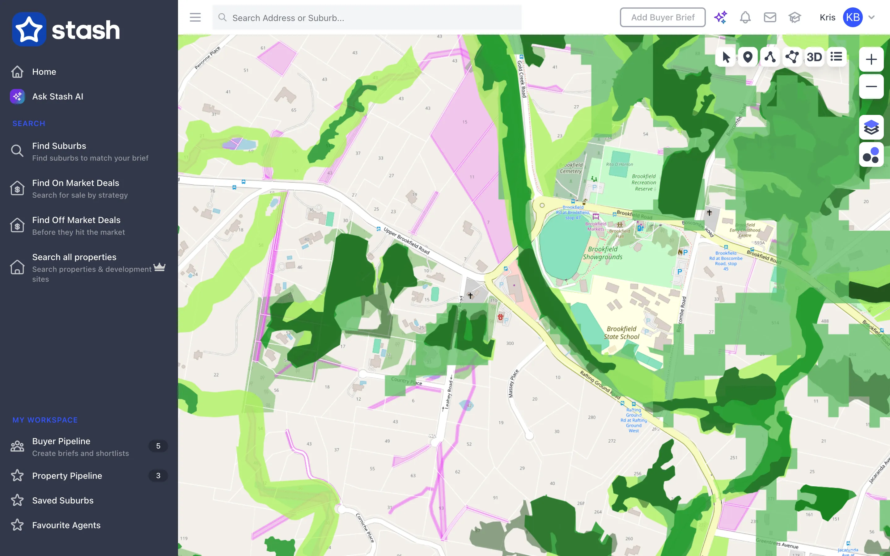
Biodiversity mapping shows where protected vegetation, habitat or conservation areas have been identified. These can limit clearing, building envelopes and subdivision, so check them before you buy a development site. Stash shows biodiversity as a map overlay and on each property page.
Before you start
Map overlays need an active Stash subscription or free trial. If Biodiversity shows a lock icon, it isn’t included in your account. See plans.
Turn on the Biodiversity overlay
- Go to the area you’re researching. Search for a suburb or address, or move the map there.
- Open the Layers panel. Click the Layers button on the right-hand side of the map.
- Turn on Biodiversity. Under Overlays, switch on Biodiversity. Affected areas are shaded on the map.
- Choose a clear basemap. Street gives the best contrast. Switch to Satellite to compare the mapping with the vegetation you can see.
Check biodiversity on a property
- Open the property. Click it on the map, or search for its address.
- Open the Planning Insights tab. The Risks & Planning Overlays card shows Biodiversity detected, Biodiversity not detected or Biodiversity not available.
- Check the source. Below the result you’ll see the Source (for example, council) and when it was Updated. Where council and state data both exist, Stash shows the council source.

Biodiversity also appears in the Property Risks section of the property’s Planning Info page. See Minimum lot size and zoning details.
Coverage
Biodiversity data comes from state governments, plus local councils in Queensland. It’s usually updated quarterly. For other overlays and sources, see Where Stash sources its data.
Biodiversity data in Stash is a guide only. Mapping changes and may not match what’s on the ground. Before you buy, clear land, build or advise a client, check the council’s planning scheme and state environmental mapping, or speak to a town planner or ecologist.
Common questions
Biodiversity says not detected. Is the site clear?
Not necessarily. It means Stash didn’t find mapped biodiversity in the data it holds for that property. Federal protections and council rules outside the data may still apply.
What does “Biodiversity not available” mean?
There isn’t biodiversity data for that area in Stash yet.
Can I see biodiversity with other overlays?
Yes. Turn on Bushfire, Flooding or Contours at the same time. See Map layers and overlays.