

Combine Stash’s property search with recent aerial imagery to find development sites and check what’s actually on them today, without a site visit. It’s especially useful in growth areas, where Google’s imagery can be years out of date.
Before you start
- A plan that includes Search all properties. If you see a lock icon on it, see plans.
- The MetroMap add-on for recent aerial imagery. Without it, you can still use the standard Satellite basemap.
Find candidate sites
- Open the search. In the side menu, choose Search all properties.
- Choose an area. In Suburb, Postcode or Council, pick the suburb or council you’re targeting.
- Pick the zones you can develop. Under Property Zoning, tick the zones that suit your project.
- Set the size of site you need. Enter a minimum Area and Street Frontage (m). Click EXPAND LAND FILTERS to look for Splitter Blocks or Corner Blocks & Dual Access.
- Search. Click SEARCH. Matching sites appear as yellow markers on the map.
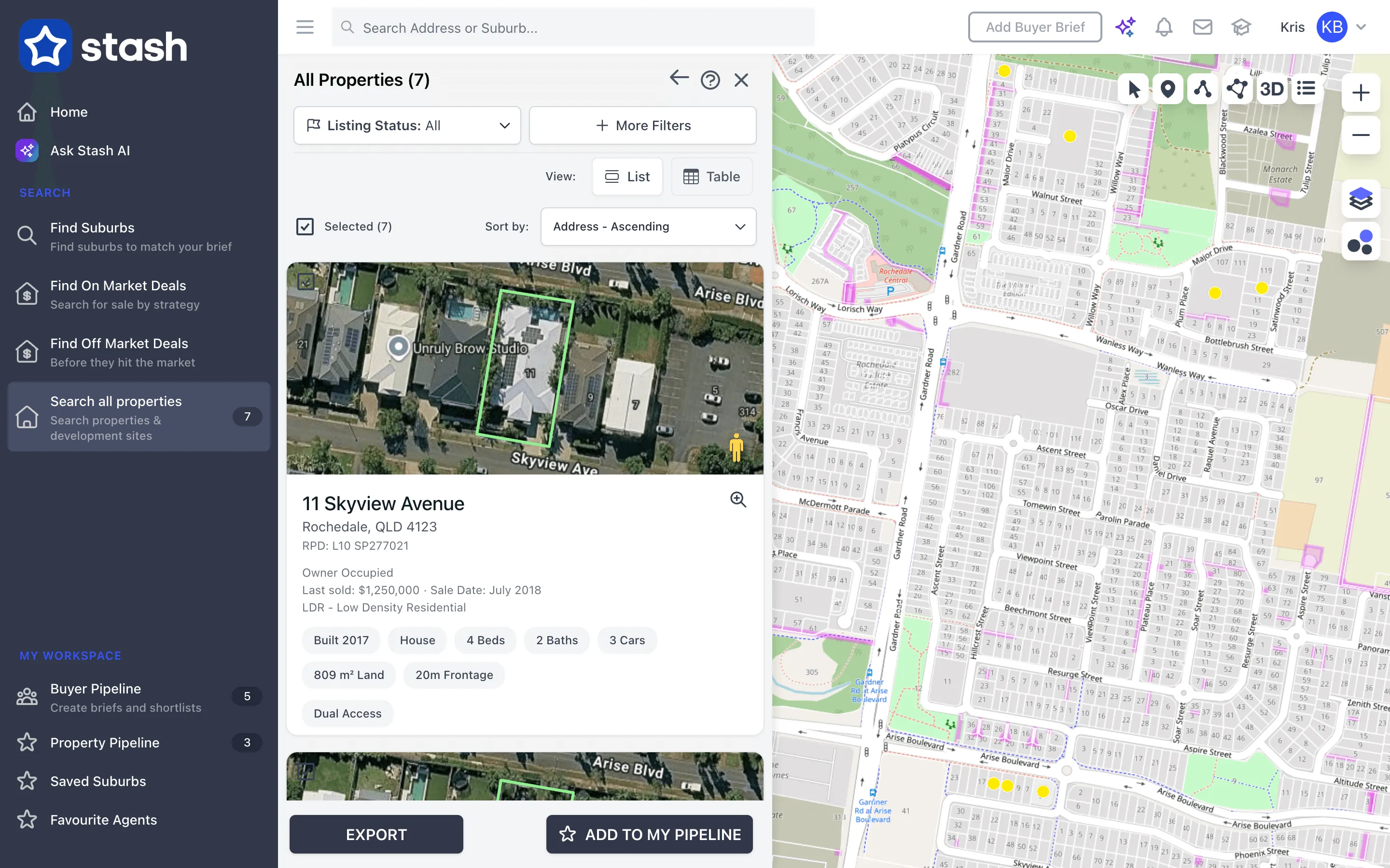
For the full list of filters, see Find off-market properties.
Check each site with recent aerial imagery
- Open a site. Click a marker or a result, then zoom in close to the property. MetroMap imagery only shows when you’re zoomed in.
- Open the layers panel. Click the Layers icon on the right of the map.
- Switch the basemap. Under Basemaps, choose Metromap Aerial. The map changes to the most recent MetroMap imagery for that area.
- Go back in time. Use the date selector on the map. It starts at Latest Metromap Aerial. Use the arrows or the list to step through earlier captures and see how the site and street have changed. See Go back in time with recent aerial imagery.
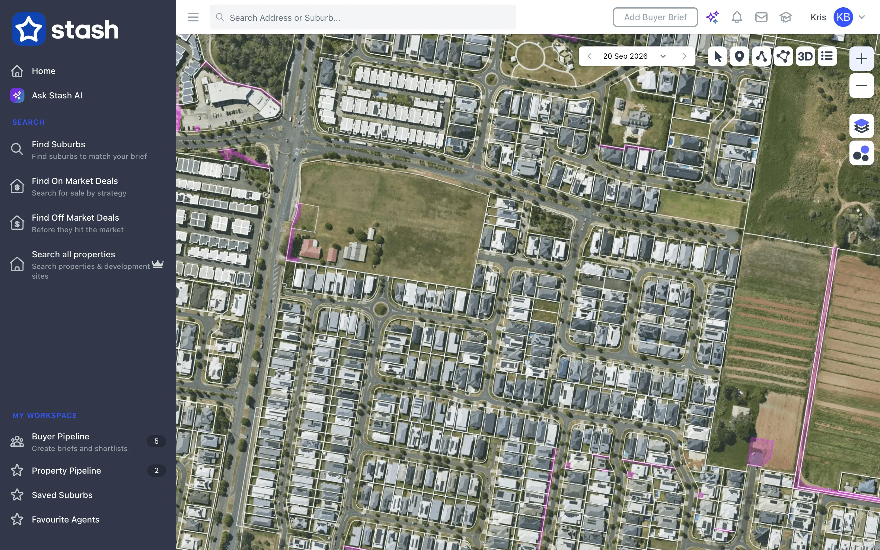
Compare the aerial with the zoning and boundaries layers. New slabs, cleared lots and finished roads show how far a nearby estate has progressed, and empty or under-used lots can point to an opportunity.
Add MetroMap to your account
- Open the Billing Centre. Click your name at the top right, then choose Billing Centre.
- Find the add-on. Under My Plugins, find Metromap.
- Activate it. Click ACTIVATE and follow the prompts.
For more on the add-on, see Turn on recent aerial imagery.
MetroMap provides up-to-date aerials in most capital cities, updated many times a year. Outside those areas, imagery may be older or unavailable.
Common questions
Metromap Aerial is greyed out in the layers panel
The MetroMap add-on isn’t active on your account. Activate it from the Billing Centre, as above.
I chose Metromap Aerial but the map looks the same
Zoom in closer. MetroMap imagery loads only at street level.
Can I include the aerial in a report?
Yes. See Create a property development report.