


Updated November 2026: the drawing tools now sit in the toolbar at the top right of the map (Edit, Add Labels, Draw Lines, Draw Area and the 2D/3D Pitch Toggle), and areas can be given a height so they show as blocks in 3D. We’ve added the current steps below.
Have you been wondering what it feels like to do your designs and add some personal touches on it? Like adding some labels and marking your maps to have easy access to those properties? Sounds simple and less hassle, right?
It’s definitely a YES with Stash v3! We know that you’ve been waiting for this and we understand how useful this feature is. That’s why we strived hard and pushed our limits to add this just for you – our valued customers!
The long wait is over folks!
Say hi to our New Feature Release: Drawing + 2D and 3D which gives you the option to measure and layout your drawings and designs in no time plus be fascinated with our interactive map.

We have added some additional options to make your search more exciting!!!
Our Drawing feature:
- Allows users to add labels – mark your map with labels, i.e. POI, Landmarks, etc.
- Gives easy access to the maps and allows users to identify the landmarks on the map through its labels.
- May also add a label when using the ‘Draw Lines’ feature to signify the measurement done
- Allows to switch from 2D to 3D view
- Draw your designs and view them in 3D to have a better look at how your project would be.
- ‘Draw Lines’ and ‘Draw Area’ feature allows users to measure the area and distance of the property to the nearest schools, supermarkets, parks, etc. with the advanced feature to edit its attributes.
- Save or delete some presets that can be used for future references and research
- Save your design by adding some presets that will be useful for future projects and other prospect properties.


How to draw and view your design in 3D today
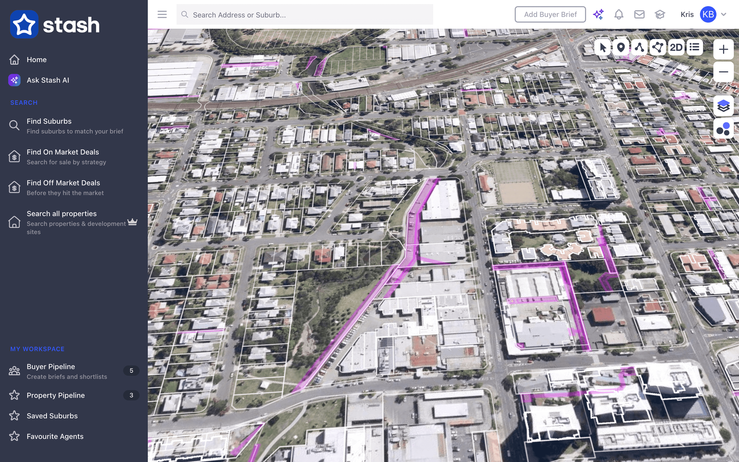
- Go to the site. Search for the property or move the map there and zoom in close. An aerial basemap, such as Satellite, makes tracing easier.
- Click Draw Area in the toolbar at the top right of the map. Click each corner on the map, then double-click to finish. The box shows Distance (m), Distance Total (m) and Area (m²) as you draw.
- Set the attributes. Add a Label, choose a Color, set a Height [m] and the Opacity, then click Save. Use Draw Lines for roads or distances and Add Labels for landmarks.
- Switch to 3D. Click the 3D button (Pitch Toggle). Areas with a height show as blocks, a quick way to picture building bulk on a site. Hold Command (Mac) or Ctrl (Windows) and drag to rotate, and click 2D to go back.
- Save a preset for styles you reuse: click the … button next to Preset and choose Save preset.
Your drawings are saved to your account and show through the My Drawings overlay in Layers. The drawing toolbar is available in Stash in your web browser, not the mobile app. See Use the drawing tool, Switch between 2D and 3D view and Measure area.
Your feedback means a lot to us that’s why we tried our best in including this on our platform to help you more with your projects and property search journey.
Along with the updates we’ve made, we’ve also considered our not so tech-savvy customers and made sure that they’ll be able to follow through with all our newly added features.
Fascinating, right?
Start a free trial today, no credit card needed, or reach out to us at support@stashproperty.com.au for more information and start searching for your next great deals.
Happy Stashing!